 It has been there for years, waiting quietly downstream as we drifted along, waiting patiently until we reached there. And now we have reached there; reached that stage in our development. The Batoka Gorge Dam.
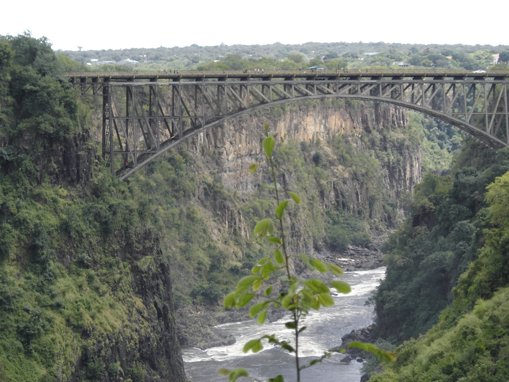
The first geological studies of the Batoka Gorge were undertaken in 1904 when the Victoria FallsBridge was being constructed and when the Victoria Falls Hydro Electric Scheme was being planned (the Victoria Falls Hydro Electric Scheme was not realised until 1938). In 1972 a report, by Sir Alexander Gibb & Partners (who also worked on Kariba Dam) prepared on behalf of the Central African Power Corporation (CAPCO) , identified a number of suitable sites on the Zambezi for development as hydro schemes. These included Batoka Gorge and Devil’s Gorge, upstream of Kariba and Mupata Gorge, downstream of Kariba. A further report by Gibb in 1981 relocated the dam site some 12 kilometres upstream, due to a mapping error. The current technical, legal and environmental feasibility studies were carried out in 1993.
When plans to build this dam were resurrected in 1993, a major obstacle was the settlement of outstanding debts owed to us by Zimbabwe, dating back to the division of jointly owned assets from CAPCO. According to the announcement made earlier this year, Zimbabwe have now agreed to pay back the US$ 70 million, finally settling this issue and thereby opening the way to the building of the Batoka Dam.
The proposed Batoka Power project site is located approximately 50 km below the Victoria Falls on the Zambezi River and once completed will supply a total of 1600 MW of power to Zambia and Zimbabwe. It is also believed that the project could enhance generating capacity at Kariba power station, downstream of the Batoka Gorge site, by 300 MW. The proposed dam has a wall 181 metres high and two underground power stations. Depending on what you are reading, the surface area of the dam is around 26 square kilometres and the reservoir would back up for nearly fifty kilometres, completely flooding the Batoka Gorge below the Victoria Falls. Bids for the construction of the dam on a Build, Operate, Transfer basis were invited in December last year and the tender closed in February 2013. The estimated construction cost is US$ 2.5 billion and it was announced on 4 April that the Zambezi River Authority has shortlisted six international investors. The World Bank has also shown an interest in the project.
The reasons being advanced for the construction of this dam is that both Zambia and Zimbabwe are suffering from national power deficits and need to increase their power generating capacity. As the economies of both countries grow, these deficits are going to become more acute. Solving Zimbabwe’s power deficit is seen as a crucial factor in their recovery.
Trying to establish precisely what Zimbabwe’s generating capacity is and what their peak demand is, is difficult. However, it seems that the generating capacity is around 1,400 MW and their peak demand is 2,200 MW. It is reported that there have been no significant investments in power generation in Zimbabwe since 1980. The importation of power is not a realistic and sustainable option especially since the entire region is facing a deficit. In addition, Zimbabwe’s track record on paying for power imported by them from neighbouring states is not good. Zambia and DRC are specifically mentioned in the report and, as an aside, it would be interesting to know how much, if any, is still owed to ZESCO/Zambia for exports to Zimbabwe.
Back home in Zambia, according to the ZESCO website, we have a generating capacity of 1,800 MW, with a 70 MW power deficit during peak periods. Also according to the ZESCO website, by 2015 our generating capacity will be 3,000 MW, excluding any new dams being built on the ZambeziRiver. If this information is indeed correct and realistic, then it would seem that our domestic power requirements are pretty much taken care of, at least for the next few years, without the Batoka Dam and we will still have enough to export to the region. In addition to this Zambia has further hydro capacity to increase our generating capacity to 6,000 MW although, I believe this includes the Batoka Dam and two other dams on the Zambezi at Devils Gorge and Mupata Gorge.
Given the above, the question in my mind is whether we, Zambia, really need this dam or is it only being built at the behest of our southerly neighbour?
Looking further, what will be the impact of this dam? Remember that the environmental feasibility studies were carried out in 1993. They are however to be reviewed this year. Without a doubt, there will be an impact on the environment.
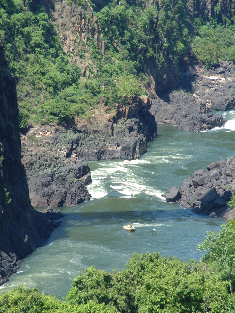
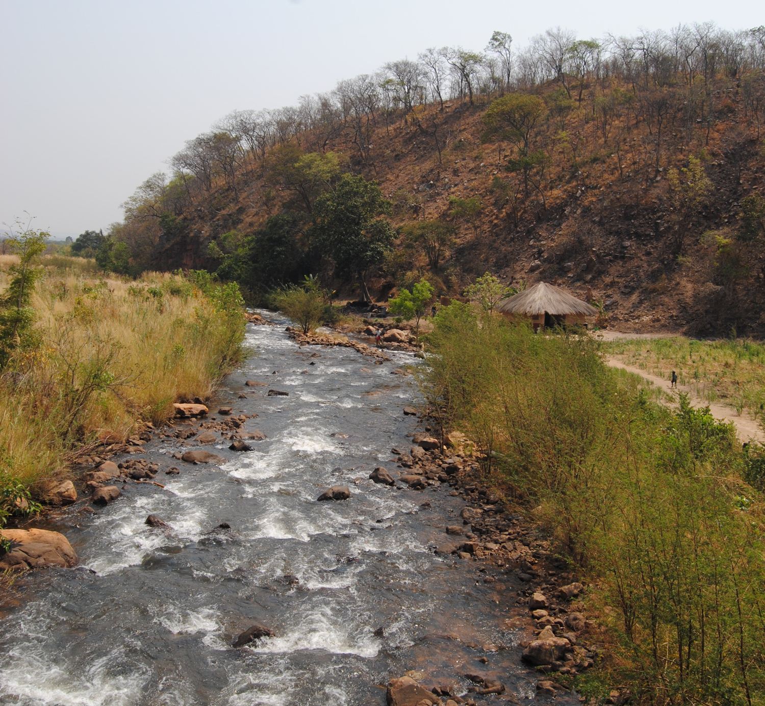
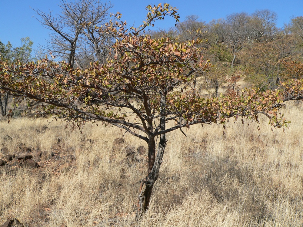
After tumbling over the magnificent Victoria Falls, one of the natural wonders of the world and a World Heritage site, the ZambeziRiver transforms from a docile river to a fierce torrent cutting through the dramatic gorges until reaching the once again placid and mostly peaceful waters of LakeKariba. From the Victoria Falls, the Batoka Gorge system is about 120 km long. The river has carved its way through the basalt rock to make a gorge which is about 140 metres deep. The dramatic landscape comprises cliffs and screes. The flat plain on top of the gorge supports mopane woodland. Riparian forest occurs in parts along the Zambezi and some of the gorges formed by tributaries. The screes are covered in thick mixed woodland interspersed with grassland.
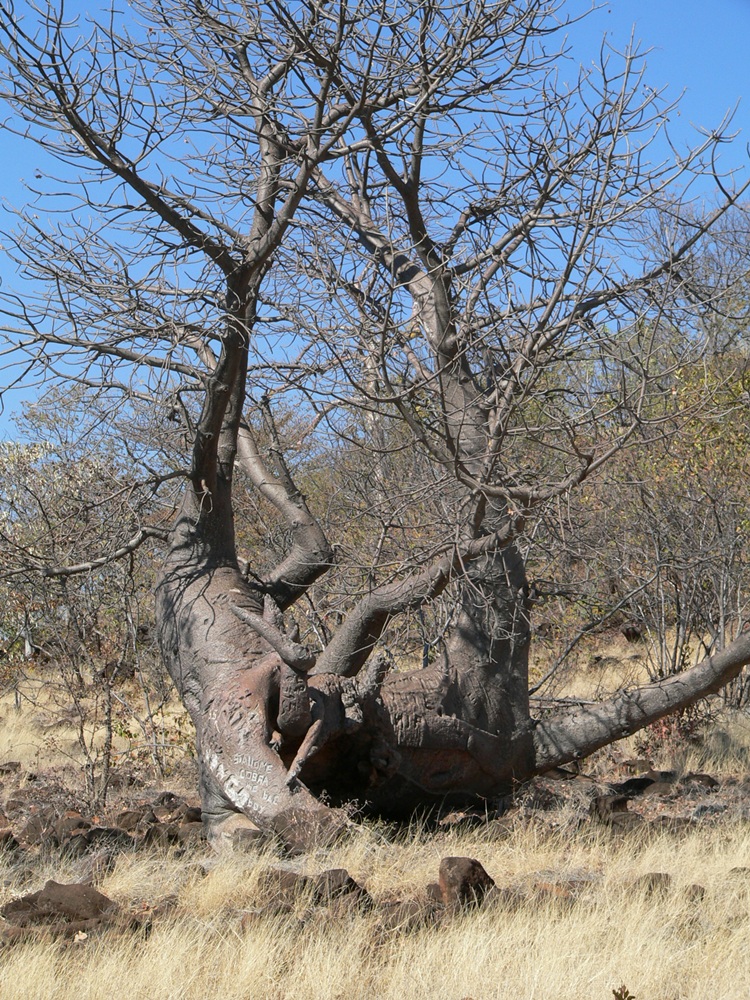
The steep walls of the gorges, where not too sheer, support mixed deciduous woodland typified by small to medium sized paper bark trees, which form mostly on the moister sheltered sides of the river gorge. On the harsher slopes of the gorge are found two rare and localised tree species, Entandrophragma caudatum and the Propeller Tree (Gryocarpus americanus) which is of note for its wind-borne seed with two lobed wings which propel the seed to the ground.
Of note on the shrub species found in the gorge, is the Everlasting Plant noted for its adaptation to the seasonal variations in moisture which allow the plant to almost completely dry out, only to revive from the dead when water returns.
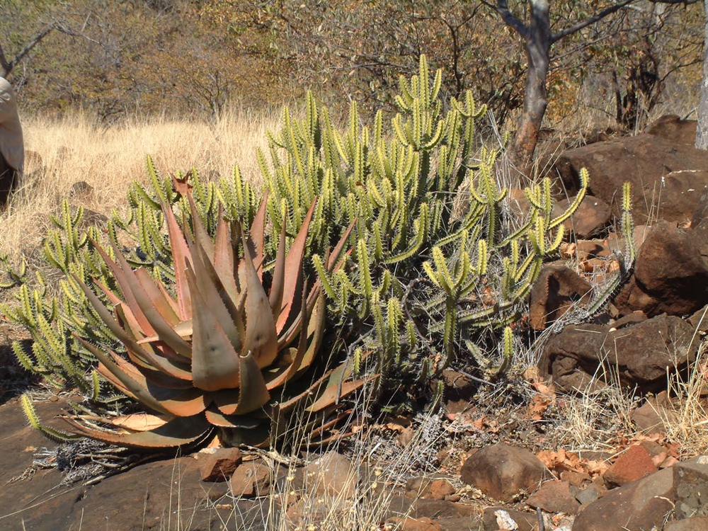
On drier, more exposed, rock faces, tree species are replaced by Aloes, with their red flowers. Aloe cryptopoda has the distinction of being discovered by David Livingstone’s 1859 expedition
The Batoka Gorge is listed as an Important Bird Area by Birdlife International on the basis of its conservation importance. The Taita falcon, a small, agile and endangered species breeds there, as do many other rare birds of prey, such as Verraux’s eagle, lanner and Peregrine falcon. Thirty four species of raptor occur or have been seen in the gorge, including owls.
The Taita falcon is patchily distributed from eastern to southern Africa. It breeds in highlands and mountain regions with high cliffs and river gorges, mainly in areas with low rainfall. It is a scarce species, with probably around 1,000 adults. The flooding caused by the proposed dam will threaten the breeding pairs which are normally found in this gorge.
The site of the dam is below the MoembaFalls and the 50 kilometre length of the reservoir will be entirely within the Batoka Gorge. This will be a deep, lifeless and ecologically bankrupt lake and will therefore not sustain a commercial fishing industry as LakeKariba has done.
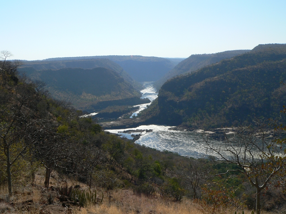
Today there is very little usage of the gorge itself except for white-water rafting and kayaking, with the Batoka Gorge being world renowned as the most challenging, tempestuous and the best commercially operated white water rapids in the world; a major attraction for Livingstone. The development of the Batoka Gorge Dam threatens to destroy this tourist business as it will also completely destroy the natural river in the middle Zambezi.
But it is not only about seemingly sentimental tree-hugging stuff. A hydrologist from the US State of Wisconsin Department of Safety and Professional Services recently stated “that many existing and proposed hydropower dams are not properly evaluated for the risks of natural hydrological variability, which is extremely high in the Zambezi river, not to mention the risks posed by climate change.” As a result of climate change, the Zambezi will experience worse droughts and more extreme floods; the worst potential effects of climate change among eleven major sub-Saharan African river basins. Multiple studies estimate that rainfall across the basin will decrease by 10% to 15% resulting in significant warming and therefore higher evaporation rates. Large dams evaporate more water than natural rivers and these very dams could worsen local water shortages resulting in less water for hydropower. More than 11% of the Zambezi’s mean annual flow is lost to evaporation from dams, which increases the risk of shortfalls in power generation and extensively impacts on downstream ecosystem functions. The design of the Batoka Gorge dam is based on historical hydrological records and have not been evaluated for the risks associated with reduced mean annual flows and more extreme flood and drought cycles. Thus the dam is unlikely to deliver the expected power output. The occurrence of more frequent extreme floods threatens the stability and safe operation of large dams. Extreme flooding events, a natural feature of the Zambezi river system, have become more costly downstream since the construction of large dams. If dams are ‘underdesigned’ for larger floods, the result could be serious safety risks to millions of people living in the basin. (Source: www.nepadwatercoe.org)
And let us not forget greenhouse gas emissions. Dams in the tropics have two principle greenhouse gas emission sources: carbon released from soil carbon stocks and dying vegetation when the reservoir is flooded and methane formed where organic matter decays under low oxygen conditions at the bottom of the reservoir. Methane emissions are helped along by a dam’s turbines, which draw from the bottom of the reservoir and spray methane-dense water into the air upon release. Emissions from rotting vegetation occur on an ongoing basis when the levels of the reservoir fluctuate: during the dry season weeds emerge from the muddy drop-down zone, only to rot again when waters return. The effect turns a dam into a “methane factory”. Dams can also be enablers of deforestation, spawning roads that facilitate new clearing for farms etc. A recent study found that greenhouse gas emissions are still occurring ten years after dams are constructed.
Dams further compound pollution problems in rivers. Free-flowing rivers with sufficient oxygen and balanced natural nutrients reduce or remove the toxicity of any contaminants that have seeped into the river. By reducing the rivers’ ability to flush out pollutants, contaminants accumulate in the reservoir and submerge any vegetation. This in turn rots. Apart from the greenhouse gases emitted from this rotting vegetation, the water can also become highly toxic with significant ecological effects downstream, not to mention the effect on human health (Source: www.mongabay.com)
Experts have also expressed concern regarding the impact on the biologically rich and productive Zambezi Delta, the largest estuary wetland complex on the eastern coast of Africa as a result of the construction of the proposed Batoka Gorge dam, the Mphanda Nkuwa Dam to be built in Mozambique as well as the existing dams, Kariba and Cahora Bassa. They have predicted that the estuary would be completely dessicated.
We mentioned earlier that the environmental feasibility studies were carried out in 1993. So too were the legal feasibility studies. Legal issues will not only involve Zambia and Zimbabwe, but also quite conceivably Mozambique, downstream of us. Certainly the operations of Kariba such as opening and closing the flood gates has to take into account the people downstream in Mozambique’s Zambezia Province who are deeply affected with flooding, crops and homes washed away, schools, bridges and roads damaged. Also to be considered is the Memorandum of Understanding signed by Angola, Namibia, Botswana, Zimbabwe and Zambia on the Kavango Zambezi Transfrontier Conservation Area as the proposed dam site is well within the KAZA TFCA area.
Also to be considered is the Matabeleland Zambezi Water Project, work on which has already started. This project aims to pump large quantities of water from the Zambezi to the Zimbabwean town of Bulawayo, by way of various dams and a 450 kilometre pipeline. We also understand that Botswana wishes to tap water out of the Zambezi which is eventually going to make its way to South Africa. Zambia, and quite rightly so, refused to sign the Zambezi River Protocol and argued that 75 percent of the Zambezi River basin is in Zambia and Zambia contributes 42 percent of Zambezi River water. Therefore, Zambia wants this natural advantage to be factored in when it comes to water abstraction from the ZambeziRiver. An agreement was finally reached but more about this in the future.
The legal side of this dam will also be interesting given that it is to be constructed on a Build, Operate, Transfer basis. A private investor will build and operate it for some years and then transfer ownership once said investor has recouped its investment. One assumes that in the interim Zambia and Zimbabwe will buy power from the private investor. It will be interesting to see how this is negotiated and how it pans out in practise.
It is abundantly clear that there is much more to the construction of the Batoka Gorge Dam than first meets the eye. The impact is going to be enormous, with both positive and negative impacts. Yet this project has already gone to tender and the public, in general, seem to know very little about it. One has to assume that a full Environmental Impact Assessment will be conducted and that the public will be entitled to have an input in the process and that their input will be taken into account when arriving at the final decision.
As a sovereign country, but also as a member of the SADC regional community, we need to find solutions that ensure sufficient power generation, both at home and regionally, to ensure economic growth so that our citizens may prosper and so that we may raise the standard of life and of living for ALL of our citizens. In planning infrastructure and other developments, we need to make sure that whilst improving something in one area we are not creating a problem in another area. In this particular case, perhaps now is the time for Zambia to consider and adopt a policy on whether multiple smaller hydropower stations should be built in preference to one or two large dams with their hydropower schemes. But whatever decisions are made, the course of action must be for the benefit of Zambian citizens first, and the region second. In arriving at these decisions, citizens should be consulted and their input taken into account. It is only through consultation and discussion that problems are solved to the satisfaction of all players; the not-so-elusive Win-Win situation.
Leave a Reply
You must be logged in to post a comment.